Switzerland is home to some of the most amazing hikes in Europe and hiking mountain-scapes.
I've spent a lot of of time hiking in the Swiss Alps. Here are my favourite day hikes in Switzerland.
Please note: I haven't included multi-day hikes that pass through Switzerland, like the Walker's Haute route, the Tour du Mont Blanc and the Monte Rosa hike.
Best Hikes In Switzerland
The Eiger Trail
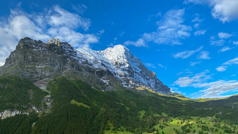
View of the mighty Eiger. Photo credit.
- Distance: 6 kilometers (3.7 miles)
- Length: 2 to 3 hours
- Difficulty: Easy
I grew up reading books about the Eiger (I recommend Eiger Dreams by Jon Krakauer), so when I got an opportunity to hike the Eiger Trail I was super excited as it passes right by the North Face of the Eiger. The trail passes through lush meadows and rugged mountain landscapes in the Bernese Oberland region.
The one-way hike spans approximately 6 kilometers (3.7 miles) and takes about 2 to 3 hours to complete. With only a moderate incline and well-maintained paths, the hike is suitable for most hikers, including families.
The best time to hike the Eiger Trail is from June to September. July and August offer the warmest and most stable weather conditions. June or September provide a quieter experience and more vibrant colors in the landscape.
Aletsch Glacier Panorama Trail
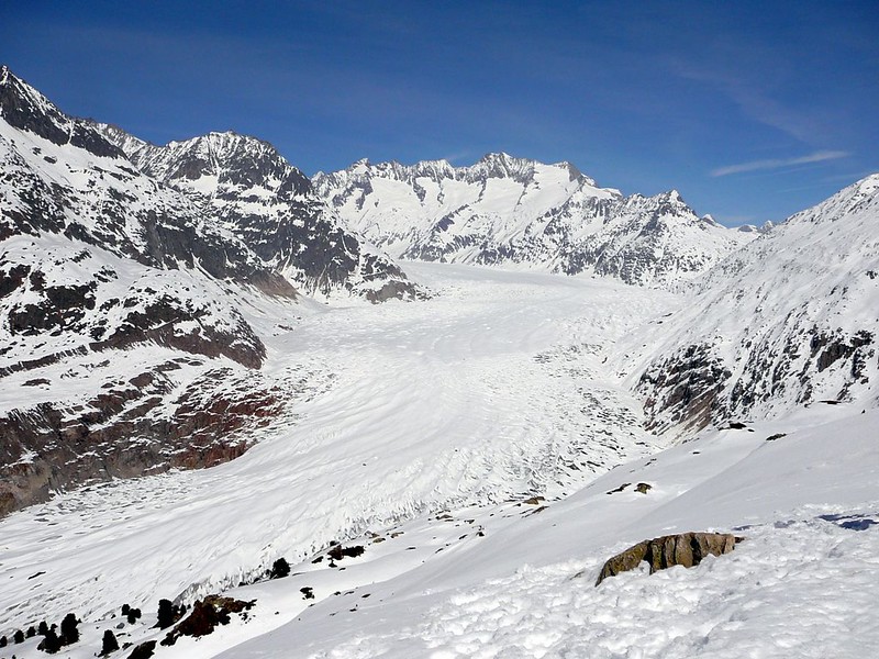
Aletsch Glacier in winter. Photo by Jessica Gardner.
- Distance: 12 kilometers (7.5 miles)
- Length: 4 to 5 hours
- Difficulty: Easy
The Aletsch Glacier Panorama Trail is an awesome hike in Switzerland. It's pièce de résistance is the Great Aletsch Glacier, the largest glacier in the Alps. The trail offers incredible panoramic views, including the towering peaks of the Valais Alps.
The trail covers approximately 12 kilometers (7.5 miles) one way, the hike takes about 4 to 5 hours to complete. The trail features gentle inclines and well-maintained paths, making it suitable for hikers and families with a moderate fitness level.
Like most hikes in Switzerland, the best time is June to September. I hiked the Aletsch Glacier trail in August and found the paths quite busy but not overly so.
Hornliweg Hike
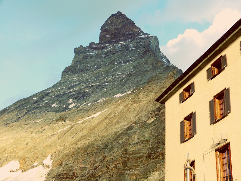
Hörnlihütte with the Matterhorn in the background. Photo credit.
- Distance: 4.8 kilometers (3 miles)
- Length: 3 to 4 hours
- Difficulty: Moderate
The Hornliweg hike, also known as the Hörnlihütte hike, is a thrilling trek in Switzerland that leads to the Hörnli Hut, the famous base camp for climbers attempting to scale the iconic Matterhorn.
If you love the Matterhorn as much as I do, then this hike is for you as it offers spectacular views of the iconic peak, as well as the surrounding peaks in the Swiss Alps.
The one-way hike covers approximately 4.8 kilometers (3 miles) and takes about 3 to 4 hours to complete.
There are a few steep inclines and rocky terrain areas that make this hike better suited for hikers with a good fitness level and some experience in the mountains.
Pizol Lake Hike
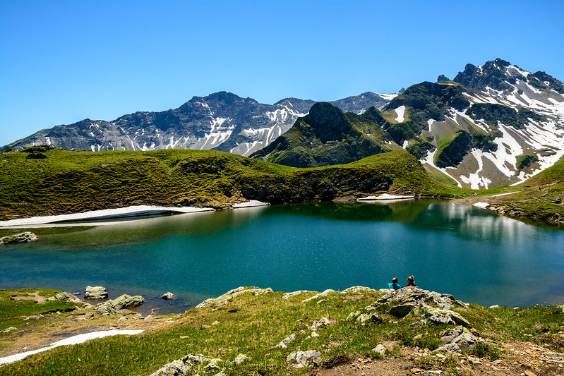
Pizol Lake. Photo by Domenico Convertini
- Distance: 11 kilometers (6.8 miles)
- Length: 4 to 5 hours
- Difficulty: Easy to Moderate
The Pizol Lake Hike is a wonderful day hike in Switzerland. The route takes hikers on a journey through the picturesque Pizol region, famous for its five stunning alpine lakes. Each lake has its own distinct character and provides great photo opportunities.
It's a circular hike that covers approximately 11 kilometers (6.8 miles) and takes about 4 to 5 hours to complete. The trail features moderate inclines and well-maintained paths, making it suitable for hikers with a moderate fitness level.
Hardergrat Trail
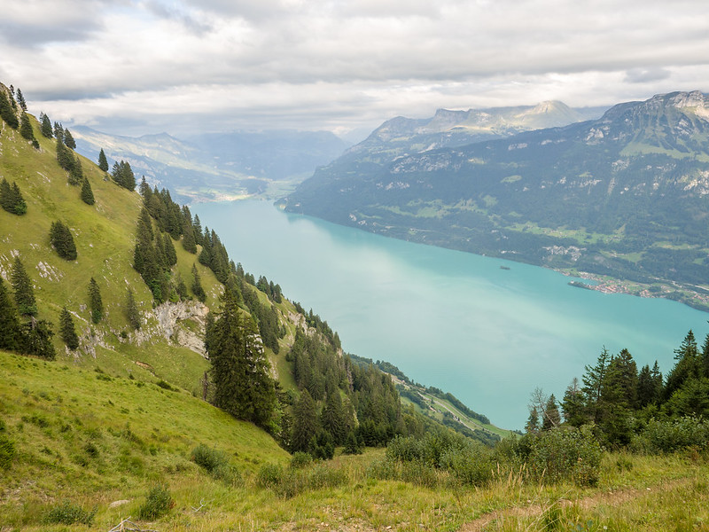
Lake Brienz. Photo by James Petts
- Distance: 27 kilometers (16.8 miles)
- Length: 10 to 12 hours
- Difficulty: Moderate to Hard
The Hardergrat Trail is one of the more challenging day hikes in Switzerland.
The route is renowned for its thrilling section along the narrow Hardergrat ridge. On the trail you'll get epic views of Lake Brienz, the surrounding Swiss Alps, and the lush landscapes of the Bernese Oberland region.
Here's the bad news. The one-way hike covers approximately 27 kilometers (16.8 miles) and takes about 10 to 12 hours to complete. It's definitely not a walk in the park, with some tough inclines and exposed sections.
If you are relatively fit with lots of hiking experience then the Hardergrat is for you, otherwise I recommend choosing one of the other day hikes in the list.
Oeschinensee Panorama Hike
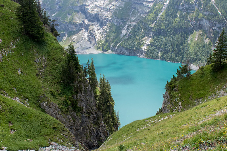
Lake Oeschinen. Photo by Jorge Cancela.
- Distance: 6 kilometers (3.7 miles)
- Length: 2 to 3 hours
- Difficulty: Easy
The Oeschinensee Panorama Hike takes you to the impressive Lake Oeschinen, a UNESCO World Heritage site. If you've never seen a glacial turquoise lake, this one will blow your mind.
The circular hike is approximately 6 kilometers (3.7 miles) and takes about 2 to 3 hours to complete. It's relatively easy going, so suitable for basic nature walkers and kids too.
All hiking trails usually close during the winter, although sometimes there is a snowshoe trail (which is admittedly quite challenging). Come June though, the trails open.
Creux du Van hike
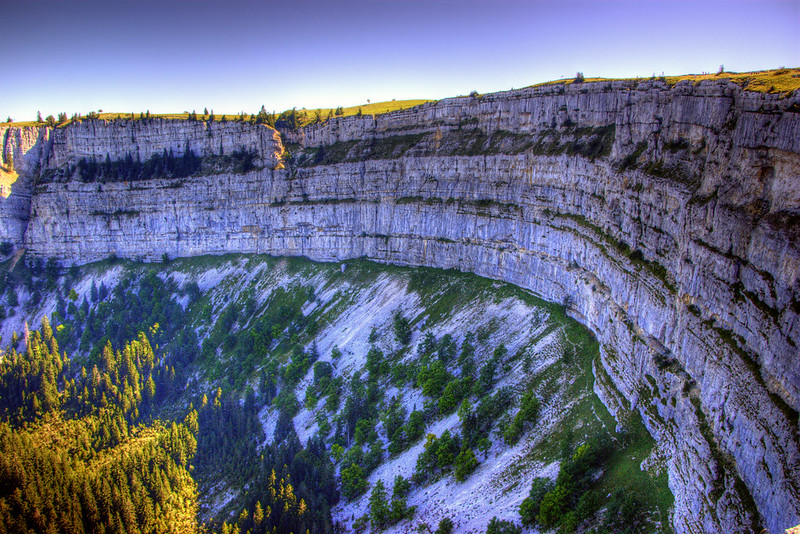
Creux du Van. Photo by Martin Abegglen
- Distance: 14 kilometers (8.7 miles)
- Length: 4 to 5 hours
- Difficulty: Easy
The Creux du Van hike is a wonderful trek in Northwestern Switzerland. The route takes hikers to the awe-inspiring natural rock amphitheater known as Creux du Van. But you will also get good views of the surrounding Jura Mountains.
The Creux du Van hike follows a circular trails that covers approximately 14 kilometers (8.7 miles) and takes about 4 to 5 hours to complete. Although there is an option to drive up to parking near Restaurant Le Soliat, from here it's a 300m stroll to the rock amphitheater.
The best time to hike the Creux du Van is from May to October, with June to September offering the warmest and most stable weather conditions. The hike is relatively easy and suitable for families.
Mount Rigi Panorama Trail
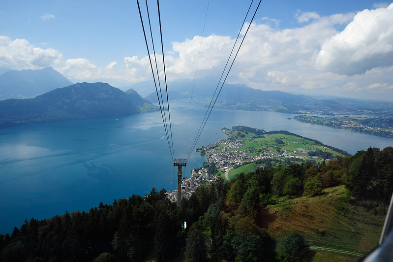
Mount Rigi cable car. Photo by Keith Ellwood
- Distance: 7 kilometers (4.3 miles)
- Length: 2 to 3 hours
- Difficulty: Easy
If you're visiting Central Switzerland and want to get classic panoramic views of the Swiss Alps, Lake Lucerne and Lake Zug, then I recommend checking out the Mount Rigi Panorama trail.
The hike is not too far from Zurich or Lucerne, and therefore provides a great hiking option for tourists in the region.
To start this hike, you first ride the Rigi mountain train to Rigi Kulm. From here you follow the signs for the panorama trail that takes you to Rigi Scheidegg. The hike covers approximately 7 kilometers (4.3 miles) and takes about 2 to 3 hours to complete. At Rigi Scheidegg there is a restaurant and play area, as well as a cable car that brings you back down into the valley.
Lauterbrunnental Glacial Valley hike
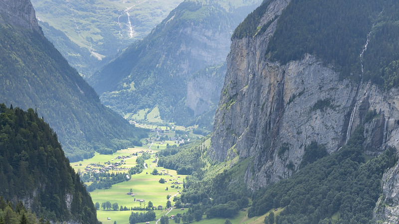
Lauterbrunnental Valley. Photo credit
- Distance: 10 kilometers (6.2 miles)
- Length: 3 to 4 hours
- Difficulty: Easy
Lauterbrunnen Valley in famous for its towering cliffs, cascading waterfalls (there are 72, and some as high as 400m), and lush alpine meadows. The Lauterbrunnen Valley hike is a relatively easy way to experience the breathtaking views in and around the valley.
The hike starts in Lauterbrunnen town. You need to follow the signs to the waterfalls (towards the mountain and away from the railway station). There are a number of detour trails to choose from but the most popular hike covers approximately 10 kilometers (6.2 miles) and takes about 3 to 4 hours to complete.
It's easy gong and well marked - ideal for families and those with moderate fitness.
Switzerland Hikes FAQ
What is the best month to hike in Switzerland?
The best month to hike in Switzerland is typically from June to September, when the weather is warmest and trails are more accessible.
Which area in Switzerland is best for hiking?
The best areas for hiking in Switzerland are the Bernese Oberland, the Swiss Alps, Valais, and the Engadin Valley.
Do you need a hiking pass in Switzerland?
Generally, you do not need a hiking pass in Switzerland. However, some specific areas or attractions may require a pass or permit, so it is always best to check ahead.
Where can I hike in Switzerland to see 6 countries?
The Säntis Mountain in the Alpstein Massif offers a unique viewpoint where, on a clear day, you can see six countries: Switzerland, Germany, Austria, Liechtenstein, France, and Italy.
What is the most scenic pass in Switzerland?
The most scenic passes in Switzerland include the Furka Pass, Grimsel Pass, and Gotthard Pass.
Can you hike alone in Switzerland?
Yes, you can hike alone in Switzerland, but always make sure to inform someone of your plans, check the weather forecast, and carry essential gear and a map to ensure your safety.
More hikes in Europe:

I need more detail schedule.
See here for detailed Swiss hike itineraries: https://www.skyhookadventure.com/go/switzerland