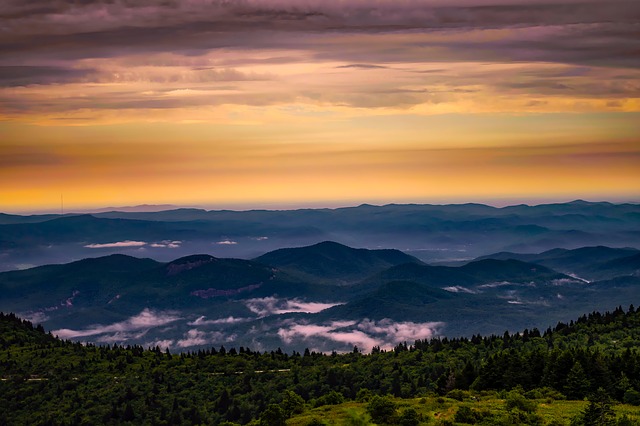
No American hike bucket list can be complete without exploring at least one of the beautiful Smoky Mountain Trails.
If you are thinking of exploring the Smokies we have put together the best Smokey Mountain hikes that you simply cannot miss.
Best Smoky Mountain Hikes
1. Porters Creek Trail
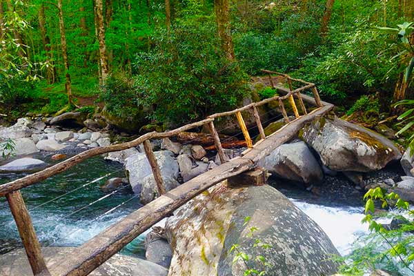
Photo by Chris Brown
- Area: Greenbrier
- Permit: Only needed if you are staying overnight in the backcountry
- Difficulty: Easy to moderate
- Distance: 4 miles
- Elevation Gain: 700ft
- Best Time to Hike: April and May, there will be many wildflowers in bloom
The hike starts off easily and meanders along an old gravel road. The path winds through a forest following the banks of Porter’s creek. After crossing a footbridge you will reach a fork in the path, and for the next two junctions you should veer left.
After crossing a second footbridge the path will wind its way to Fern Branch Falls. The hike ends here but you can choose to make it longer, by continuing onwards to Backcountry Campsite 31.
Accommodation: Le Conte Lodge (there are no other motels or lodgings in the park available, and the lodge can only be reached by foot) or Smokemont is the closest group campsite. Alternatively, you can find unique places to stay in the Smoky Mountains with cozycozy accommodation search engine.
Trail Top Tips
- Be aware of parking lot thieves who may break into your car to steal valuables.
- Consider packing a bear pepper spray as a protection against harm from potentially aggressive wildlife.
- If you hike during spring you might come accros yellow trillium in certain areas.
- The hike is a good option all year round, as it can still be hiked when there is thicker snow at higher elevations.
2. Alum Cave Trail
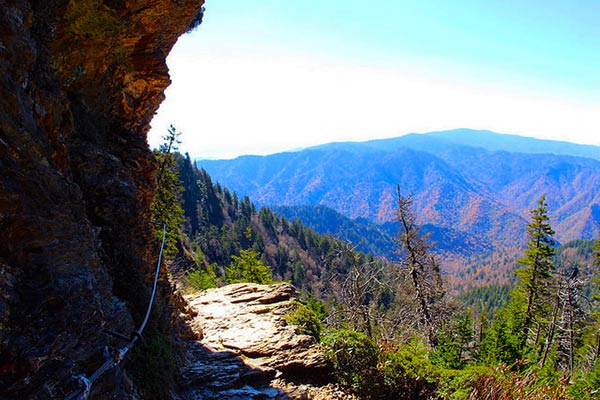
Photo by daveynin
- Area: Newfound Gap Road
- Permit: Only needed if you are staying overnight in the backcountry
- Difficulty: Moderate
- Distance: 4,4 miles round trip
- Elevation Gain: 1,125ft
- Best Time to Go: Hikes can be enjoyed throughout the year, with each season bringing its own rewards, but in winter icicles can be a hazard
The Alum Cave hike takes you through an old hardwood forest, beginning by crossing Walker Camp Prong and Alum Cave Creek. About 1.3 miles in, you should reach your first prominent landmark - Arch Rock. The trail winds beneath the arch and at reaching the top, you will begin climbing towards Alum Cave.
About halfway on the round trip trail you will reach the Cave. You can choose to turn around at this point or continue onwards to the summit of Mount Le Conte.
Accommodation: Le Conte Lodge or Elkmont being the closest group camping.
Trail Top Tips
- The trail is steep and follows the edge of a ridge in places, make sure you are prepared by wearing proper hiking shoes.
- During the winter months icicles can fall from the roof of the cave, so caution is advised during this time of year.
- Although there are two parking spots for this hike.
3. Charlies Bunion Hike

Photo by kmat
- Area: Newfound Gap
- Permit: Only needed if you are staying overnight in the backcountry
- Difficulty: Strenuous
- Distance: 8.1 miles round trip
- Elevation Gain: 1,640ft
- Best Time to Go: Hikes can be enjoyed throughout the year, with each season bringing its own rewards. Spring and early summer you will be rewarded with wildflowers in bloom.
This spectacular hike begins in the Newfound Gap parking lot.
From here you will travel along the Appalachian Trail (which takes roughly 7 days to complete) with the first part of the hike being a steady climb.
It will feel as if you are walking along the spine of the Appalachian Mountains, as you will have stunning views on either side of the ridge.
Finally you will arrive at your destination, Charlies Bunion, a rocky outcropping with a spectacular view.
Accommodation: Le Conte Lodge or close to either Smokemont or Elkemont group campsites.
Trail Top Tips
- Carry bear pepper spray as a precaution.
- Several sections of the hike you will be hiking above 6,000 feet.
- Remember to carry enough water and stay hydrated using a hydro pack.
- The trail was damaged by a fire a few years ago and still is not completely accessible.
4. Andrews Bald Hike
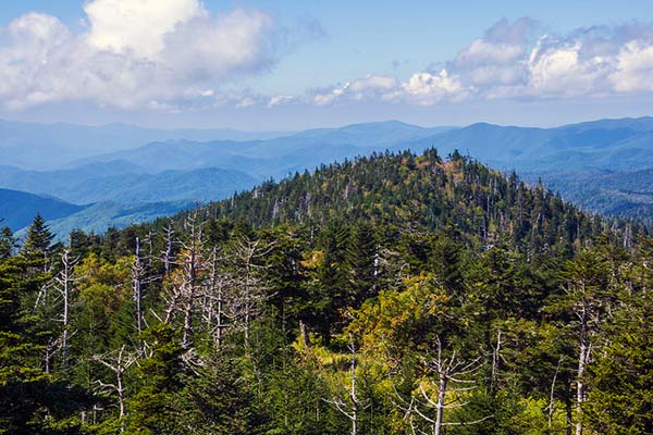
Photo by Markus
- Area: Clingmans Dome area
- Permit: Only needed if you are staying overnight in the backcountry
- Difficulty: Moderate
- Distance: 1,8 miles one way
- Elevation Gain: 1,200ft elevation change
- Best Time to Go: Hikes can be enjoyed throughout the year, with each season bringing its own rewards
The hike starts at the Clingmans Dome parking lot, beginning with a descent down the southern side of Clingmans Dome, after this climb down the hike flattens out onto a broad ridge.
The first section passes through a spruce fir forest.
After this ridge you will climb through the forest before finally reaching the grassy Andrews Bald.
Andrews Bald is a high elevation grassy meadow, and is the highest in the park.
Accommodation: Le Conte Lodge or Smokemont group campsite.
Trail Top Tips
- The trail is popular, so if you are going on weekends or in peak season get there early to avoid the masses.
- The trail is known for its outstanding views, so consider bringing a good camera to help capture its beauty.
- Hike into the grassy clearing for the best view of the southern Smokies and Fontana Lake
5. Chimney Tops Trail
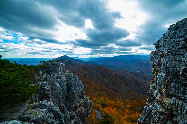
Photo by Cassandra Mosley
- Area: Glacier Point
- Permit: Only needed if you are staying overnight in the backcountry
- Difficulty: Moderate to strenuous
- Distance: 4 miles roundtrip
- Elevation Gain: 1,487ft
- Best Time to Go: Hikes can be enjoyed throughout the year, with each season bringing its own rewards
One of the park most popular hikes, this is definitely not one to be missed. The hike isn’t particularly long but provides hikers with amazing views.
The hike has a relatively steep elevation gain in a short space, so this makes for a sharp climb.
When you reach the first rock pinnacle, you will have to climb to the top to see the amazing views the hike has to offer.
Accommodation: Le Conte Lodge or Smokemont group campsite.
Trail Top Tips
- The trails steep climb means that it is a good idea to wear good hiking shoes and carry lots of water in a hydration pack suitable for mountain hiking.
- The steep rock scramble near the end can be slippery when either wet or covered in ice.
- Take going down slowly, you may need to slide down.
Hikes in the Smoky Mountains FAQ
The Smoky Mountain Range runs along the Tennessee - North Carolina border in south-eastern USA. The mountains are home to over 850 miles of hiking trails, making it a hiker’s paradise.
The mountain range is best known for being the home of the Smoky Mountains National Park, which is America’s most visited National park.
Here are FAQ about Smoky Mountain hikes.
Do I need a reservation to go on a Smoky Mountain day hike?
No you do not need a reservation for Smoky day hikes, the park doesn't even charge entrance - it is one of the few that doesn’t. However, you will need permits and reservations for overnight hikes.
When is the best time to visit the Smokies?
The Smokies can be enjoyed all year around. Spring and early summer may give rise to beautiful flowers, and winter may mean that only lower hikes are easily accessible.
Are the Smoky Mountain hikes difficult?
As there are a variety of hikes, the difficulty depends on the hike that you choose to do.
What Smoky Mountains hiking map do you recommend?
Although there is always free information available online, nothing beats a hard copy, especially when you are busy hiking. For this reason we recommend National Geographic’s waterproof, tear resistant topographic map of the Smokies National Park.
What Smoky Mountain guidebook do you recommend?
For a fantastic guide book on Smoky Mountains we recommended is Moon Great Smoky Mountains National Park (Travel Guide). The guide includes itineraries, strategies for getting around the Smokies as well as colorful images and detailed maps.
What are some interesting facts about the Smokies?
- The Smokies are a designated UNESCO world heritage site
- An estimated 1 500 Black Bears call the park home
- The park has been called the ‘Salamander capital of the world’ with 30 salamander species in five different families.
- In 2016 over 11 million people visited the National Park
- The park is named for the mist that surrounds the mountains
- There has never been a temperature recorded above 80 degrees
What type of topography can I expect in the Smokies?
Stretching from the Pigeon River in the northeast to the Little Tennessee River to the southwest, the Smoky Mountain Range form part of the Appalachian Mountain chain.
The Smokies are the tallest in the range but only form a small portion thereof.
Elevation within the park ranges from 875 feet to 6,643 feet, with sixteen of the peaks rising above 5,000 feet.
The rocks in this area are predominantly sedimentary type, which are formed by deposits of rock, which over millions of years become layers of hard rock.
What type of wildlife and plant might I see on a Smoky hike?
The Smokies are home to a variety of flora and fauna, the most famous famous probably being the great American Black Bear.
In total, the park is home to 65 different species of mammals, some of the best known being groundhog, white tailed deer and chipmunk.
With 200 species of birds, the park is every bird-watching enthusiast's dream. Interestingly, of these birds, 85 migrate from the neo-tropics.
Plants are something that the Smoky Mountains National Park is renowned for. Due to the diversity in temperature, rainfall and geology the park calls over 1,600 flowering plant species resident.
This is alongside five forest types that support 4,000 non-flowering varieties of plants.
Browse more US National Park hikes
See our picks for the Best Hikes in America, or check out these popular hikes.

