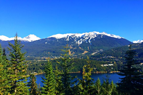
During the winter, Whistler is covered in snow and is a skiing paradise. But in summer, the snow melts away and uncovers the most beautiful Whistler hikes.
With its mountainous terrain, the hiking trails in Whistler are generally quite challenging. However, it is well worth it when you reach the viewpoints and bask in the natural beauty of the land.
We’ve put together a list of the best hikes in Whistler for you to explore if you’re visiting the area in the summertime and are looking for some rewarding outdoor adventures.
Best Whistler Hikes
Panorama Ridge
- Trailhead: Rubble Creek parking lot
- Distance: 30.9 km
- Elevation gain: 1,810m
- Duration: 9-12 hours
- Difficulty: Very strenuous
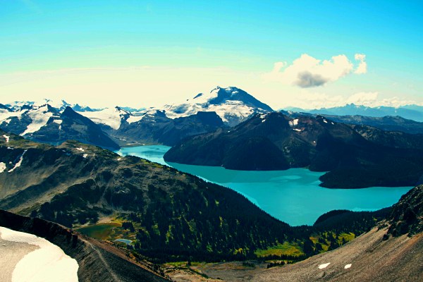
This long and challenging hike offers some of the most stunning views of the Garibaldi Lake, Helm Lake and the Black Tusk stratovolcano.
The trail begins with a steady hike through a forest and an elevation gain of about 1000 meters. It is a wide and well maintained path with multiple switchbacks that lead up to the campgrounds.
From the campgrounds, you pass through meadows of wildflowers until you begin the ascent of Panorama Ridge, where you will be treated to magnificent views of Garibaldi Lake and the surrounding mountains.
Many hikers choose to do this hike in a day but, because this is such a long and tough hike, there is the option of hiking to the Taylor Meadows or Garibaldi Lake campgrounds and camping there for the night before continuing up to Panorama Ridge the next day. If you do choose to hike the trail in one day, make sure you give yourself enough time to make the return trip to the parking lot while it’s still light.
Rainbow Lake Hike
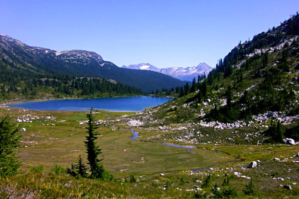
Photo by iwona_kellie
- Trailhead: Alta Lake Road
- Distance: 16 km
- Elevation gain: 850 m
- Duration: 6 hours
- Difficulty: Intermediate
Rainbow Lake is one of Whistler’s most pristine and scenic alpine lakes. It is also a source of drinking water in Whistler. Therefore, swimming and camping at the lake is prohibited.
Follow the trail next to 21 Mile Creek, which takes you up a gradual incline to a gravel road. Stay on the right side of the road as you will then take a route into the forest instead of continuing along the road.
Soon after leaving the road, you will come to a junction that leads to Rainbow Falls on the right and continues the trail to Rainbow Lake on the left. We recommended making a quick detour to see Rainbow Falls where you can enjoy a unique view of the rushing waterfall from some rocks directly above the stream.
Continue along the Rainbow Lake Trail, cross the gravel road and take the path to the right at the next junction (do not follow Flank Trail to the left). You will then come to a wooden gate and a sign with information about Whistler’s Watershed. Follow the narrow trail through the forest, past another magical waterfall, across the wooden boardwalks and the bridge until you finally reach the beautiful Rainbow Lake.
Cheakamus Lake Hike
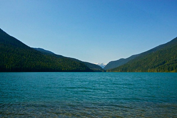
Photo by Natalia Lopes
- Trailhead: Cheakamus Lake parking lot
- Distance: 16.6 km
- Elevation gain: 500 m
- Duration: 4-6 hours
- Difficulty: Intermediate
The Cheakamus Lake hike is a beautiful, intermediate hike that offers exquisite views of the turquoise lake and its surrounding forests and mountains. This hike can also be as long or short as you prefer as the lake is only 3 km from the trailhead.
You will begin the hike with a bit of a climb, but the trail will soon level out. Follow the trail and the signs to Cheakamus Lake. Campsites are situated at the mouth of the lake for tranquil camping experiences.
Continue past the campsite on the lake-side trail for scenic views of Garibaldi Park, Mount Davidson, Corrie Peak and the Cheakamus Glacier. You can carry on hiking along the trail for as long as you feel like until you make your return trip.
One thing to note about this hike is that it can also be done on mountain bikes, so make sure you keep an eye out for bikers.
You may also like: Best hikes in Canada
Black Tusk Hike
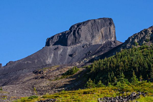
Photo by Anton Bielousov
- Trailhead: Rubble Creek Parking Lot
- Distance: 26.1 km
- Elevation gain: 1393 m
- Duration: 9-12 hours
- Difficulty: Very Strenuous
Black Tusk is an iconic Whistler hike and, while it is quite difficult, it is an absolute must for serious hikers. This hike starts the same as the Panorama Ridge hike but you’ll follow the Black Tusk signs after the Taylor Meadows campground.
You’ll hike through alpine meadows and scattered trees with stunning views of Garibaldi Lake and Panorama Ridge as you make the ascent to Black Tusk. The trail ends with beautiful views of the surrounding land. It is then possible to climb to the top of Black Tusk itself, but it is very dangerous as there is a lot of loose rock.
Garibaldi Lake Hike
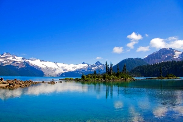
Photo by Peter M Graham
- Trailhead: Rubble Creek parking lot
- Distance: 18.3 km
- Elevation gain: 1073 m
- Duration: 5-7 hours
- Difficulty: Intermediate
This hike begins the same way as the Panorama Ridge and the Black Tusk hikes as you make your way from the Rubble Creek parking lot to the Taylor Meadows campground and follow the Garibaldi Lake signs onward.
The Garibaldi Lake hike is one of the most popular hikes in Whistler and it's not hard to see why. Along this hike you will be rewarded with unparalleled views of the sparkling lake reflecting the snowy mountain peaks and glaciers surrounding it.
After reaching the Taylor Meadows campground, you’ll continue along the trail until you reach a junction. Take the path to the right that leads to Garibaldi Lake. The wide trail will lead you down through the trees, past Rubble Creek and over a bridge to get to the Garibaldi Lake campsite.
From here you will be able to take in the glorious view of the lake, as well as the Sphinx Glacier, ‘The Bookworms’ Mountain, Castle Towers and Sphinx Mountain.
Wedgemount Lake Hike
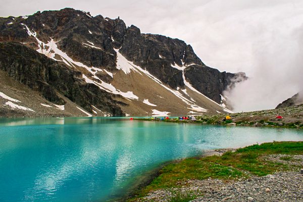
Photo by Sally Howard
- Trailhead: Wedgemount Lake
- Distance: 15.6 km
- Elevation gain: 1375 m
- Duration: 6-8 hours
- Difficulty: Very Strenuous
The Wedgemount Lake hike is known as one of the most difficult hikes in Whistler and for good reason. This hike will definitely prove a workout for your legs as you climb up steep paths and over a rock-slide area to get to the viewpoint.
However, it will all be worth it when you reach the end of the trail and are treated to the most spectacular views of Wedgemount Lake and the Wedgemount Glacier.
The hike begins with an easy, flat approach but it’s not too long until you’re making a steep ascent through some trees until you reach a boulder field. This is the toughest section of the trail and you must be careful of loose rocks.
Finally, you’ll reach a campsite where you can enjoy the incredible views and, if you’re feeling up to it, continue your hike to Wedgemount Glacier for some even more unforgettable views.
High Note Trail
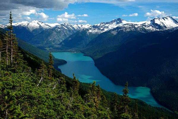
Photo by Andrew Smith
- Trailhead: Whistler Mountain
- Distance: 10.7 km
- Elevation gain: 658 m
- Duration: 3-4.5 hours
- Difficulty: Intermediate
The High Note Trail is accessed by taking the Whistler Gondola and the Peak chair lift to the top of Whistler Mountain, or the “Top of the World” as some people call it.
Once on Whistler Mountain, you’ll follow the High Note Trail signs that lead to the iconic Inukshuk that is seen in all of the Whistler Mountain summit photos. From this viewpoint you will have a panoramic view of the Coast Mountains and Black Tusk. Looking at the magnificent view from this high point, you will definitely feel as though you are standing on top of the world!
The trail continues behind the Inukshuk where you’ll carefully hike down the rocky switchbacks on the south aspect of the mountain. Once you reach the road, you will be entering backcountry and this is where the true hike begins.
The trail offers spectacular views of Garibaldi Park, Black Tusk, Helm’s Peak, Mount Davidson, Castle Towers and the beautiful Cheakamus Lake.
You may also like: Best hikes in USA national parks
Blackcomb Meadows Hike
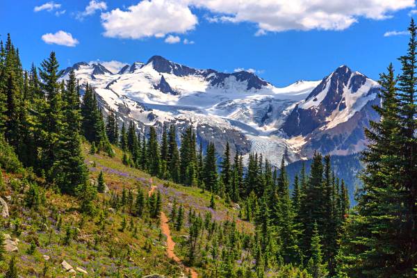
Photo by Murray Foubister
- Trailhead: Solar Coaster Chairlift
- Distance: 9.7 km
- Elevation gain: 387 m
- Duration: 2.5-4 hours
- Difficulty: Intermediate
This Whistler hike is accessible by taking the chair lift up Blackcomb Mountain and offers beautiful views of Blackcomb Lake, as well as the Spearhead Mountains. The trail meanders through the alpine terrain, passing the Fitzsimmons Lookout and leading towards Blackcomb Lake.
As you hike closer to the lake, the meadow comes into clear view with its wildflowers and lush, green vegetation. You then continue along the trail to join the Overlord path and can continue up to the Overlord Lookout where you’ll have an epic view of several mountain peaks and glaciers.
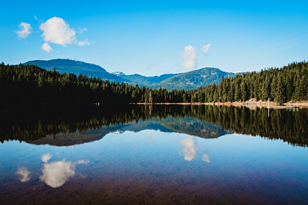
Lost Lake Hike
- Trailhead: Whistler Village
- Distance: 5.1 km
- Elevation gain: 120 m
- Duration: 1-2 hours
- Difficulty: Easy
The Lost Lake Hike is a popular hike among the locals in Whistler as it is a fairly quick and easy hike that leads to a very pretty little lake.
The trail begins past the PassivHaus (where people can rent bikes) and has two routes for you to choose from. One is a more secluded nature trail with a narrower path and generally fewer people, while the other is wider and busy. We highly recommend taking the nature trail so that you can enjoy a quiet and peaceful hike among the trees.
You will follow the nature trail all the way to Lost Lake where it will then lead you around the lake to a park where you can rest, enjoy a picnic and even have a dip in the lake. Once you’ve rested and explored the circumference of the lake, rejoin the nature trail and make your return trip to the PassivHaus.
This hike is perfect for families and beginner hikers who want to enjoy some time in nature. In addition to the pretty lake scenery, you will also find amazing views of Whistler and Blackcomb Mountains along the trail.
Ancient Cedar Trail
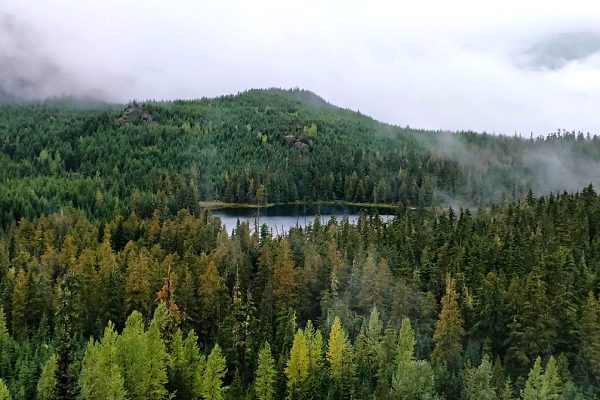
Photo by Ruth Hartnup
- Trailhead: Cougar Mountain forest service road
- Distance: 5 km
- Elevation gain: 175 m
- Duration: 2 hours
- Difficulty: Intermediate
The Ancient Cedar Trail is the perfect hike for people wanting to enjoy the spectacular scenery of Whistler but aren’t up for the more challenging hikes like Panorama Ridge, Black Tusk or the Garibaldi Lake Hike.
The trail begins at the parking area where you will walk up a gravel pathway until you reach a flat section that leads to a wider, rockier path. You will follow the trail uphill to the right and then make a left at the top to go into a forested area. There is a junction that leads to Cougar Lake on the left, which is a worthwhile detour, and continues the Ancient Cedar Trail on the right.
You will eventually come to a bridge, which marks the beginning and end-point of the loop around the Ancient Cedars. The loop takes you past a waterfall to a grove of huge cedar trees. This spot was one of the few areas not logged in Whistler - meaning that these are some of the oldest trees in Whistler.
You may also like: Best hikes in RMNP
Brandywine Falls Hike

- Trailhead: Whistler
- Distance: 1 km
- Elevation gain: -
- Duration: 30 min
- Difficulty: Easy
Just south of Whistler, you will see signs indicating the way to Brandywine Falls. This short trail takes you to a spectacular waterfall and is such a quick walk that it won’t interfere with your other plans in Whistler.
Brandywine Falls is a popular tourist spot, so the trail is well maintained and very easy to follow. It begins at the parking lot where you’ll cross a wooden bridge and follow the pathway a short distance until you reach the viewing platform.
The platform offers a magnificent view of the waterfall as it rushes down a 70 meter drop. You can also continue along the trail for a lovely view of Daisy Lake.
